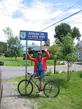
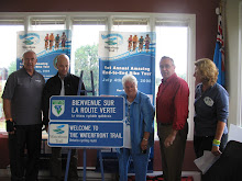
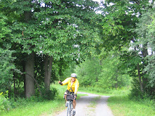
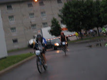
It's Ontario's best-kept secret - this wonderful stretch of waterfront trail along the St. Lawrence River. First, it's within sight of water almost all the way. Second, much of it is off-road, and the sections that are on County Roads 2 and 4, have a decent shoulder and feel safe. Third, east of Iroquois is completely flat, so the day is spent on a reasonably effortless cruise, actually enjoying the act of cycling rather than enduring it as a necessary adjunct to a pleasant way of seeing the world.
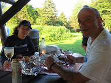
The gods of weather are with us again on Day 7, providing sun and cloud and a cooling breeze. My ankle still hurts so I stop off at the Iroquois pharmacy seeking sympathy and a professional opinion.The pharmacist doesn't even want to look at my ankle. Take Ibuprofen and do some stretching, he says. I wonder whether a bandage might be a good idea. (I rather fancy one as an ent-of-tour fashion accessory.) He looks dubious, so I back off. I decide not to mention the twinge in my knee. It's nothing, really.
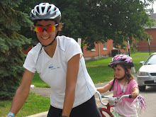
I'm just delighted with the route and it gets better all day. We go off-road at Crysler Park and cycle into Upper Canada Village, created from buildings moved from 10 villages that were flooded in 1958 to allow construction of the St. Lawrence Seaway, which tamed a dangerous stretch of river and replaced a canal system that wasn't large enough to accommodate ocean-going vessels. It was a traumatic experience and one can still meet people who struggle with the emotional loss of community and family history that comes from the obliteration of a familiar landscape.
After lunch at the Harvest Barn, the trail takes us into the charming Upper Canada Migratory Bird Centre. The path goes through various types of forest, including some beautiful tall pines. There are people fishing off a causeway and several cyclists report seeing deer. There's an interpretive centre where shiny new bicycles had just been delivered - they're going to be available for rental.
The trail finally curves up to the road and I think I'm in for some highway riding, but no - it curves back into the Long Sault Parkway, a road that links 11 islands created by the flooding. Just a marvellous area for cycling. And when it comes to an end, no, it's not back onto the highway, there's a very nice separate bicycle path that runs parallel, weaving in and out of a pleasant naturalized area - nothing short of perfect. Here we are at the Lost Villages Museum, and cyclists are coming off the trail exclaiming at how beautiful the ride has been today.
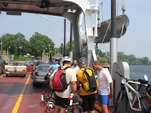
And still it goes on. There's a great paved trail all the way into Cornwall. I find myself on a long stretch with a canal on one side, the river on the other at a much lower level - which feels really strange. I'm riding alone and I go for so long that I worry I may have missed Cornwall.
I stop to ask a solitary cyclist = not part of our group = standing with his bike watching the demolition of a factory on the other side of the canal. I'm on the right track, Cornwall resident Don Bowman tells me. "What's that?" I ask, pointing at the factory. "Domtar," he says, "I worked there almost 30 years." This used to be the largest paper mill in the world, he adds. He's 51, retired on full pension. The factory may be replaced by condos. "It's sad," he says.
And then I ride on into Cornwall - which has an incredible stretch of waterfront trail. How did that happen? And why can't everyone do it?
Subscribe to:
Post Comments (Atom)


1 comment:
Thank you Kate! What an amazing read. Just as I knew you would, you've captured the poetry we felt on that trip. You also noted some of the compelling issues on our waterfront like proposals to build an ethanol plant beside a provincially significant wetland.
On the distances, a quick explanation--there is no conspiracy to mislead participants. I promise! You know me, I'm very boastful about the Trail, so it's not my style to underestimate the distance.
Getting accurate kilometre counts has always presented a challenge. DunMap's David McCarthy and I laboured over this when we developed the maps. I consulted with a few of our best trail managers (be sure to share the blame, first rule in snuffing out a rising scandal). The reasons are many but I think the most relevant is that we don't usually have bang on km for off-road sections of trail.
As well, bike odometers are not calibrated the same. Vicki and I routinely get different kilometre counts from our bike computers on rides. And I have it from a transportation expert (aka my sister) that the same can be true, though to a lesser extent, for cars and trucks.
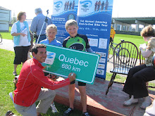
770 km they say! Well, that seems surprisingly high. Perhaps its time to see if GPS technology can give us a better read on distances.
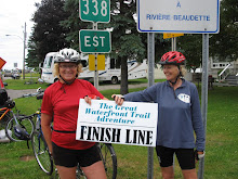
Congratulations everyone. You were a joy to be with on every kilometre!
Marlaine
Post a Comment